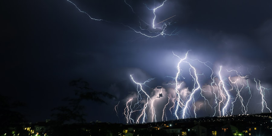
Lubbock Radar is a crucial component of the National Weather Service’s (NWS) network of weather surveillance radar. Located in Lubbock, Texas, this radar system plays a vital role in monitoring and forecasting weather patterns in the West Texas region. The radar system provides real-time data on precipitation, severe weather, and other atmospheric phenomena, allowing meteorologists to issue timely warnings and advisories to the public. Lubbock Radar has been instrumental in enhancing the accuracy and reliability of weather forecasts, ultimately helping to protect lives and property in the region.
Lubbock Radar is a Doppler radar system, which means it uses the Doppler effect to detect the motion of precipitation particles in the atmosphere. This technology allows meteorologists to not only track the intensity and location of precipitation but also to identify the presence of rotation within thunderstorms, which can indicate the potential for tornado formation. The radar system operates by emitting pulses of microwave energy and then measuring the strength and frequency of the energy that is reflected back from precipitation particles. This data is then processed to create detailed images of weather patterns, which can be used to analyze and predict upcoming weather conditions. With its advanced technology and capabilities, Lubbock Radar has become an indispensable tool for meteorologists and emergency management officials in West Texas.
Key Takeaways
- Lubbock Radar is a crucial tool for monitoring weather patterns in West Texas.
- The radar works by emitting radio waves that bounce off precipitation and return to the radar, providing information on the location and intensity of the precipitation.
- Lubbock Radar plays a vital role in monitoring severe weather events such as thunderstorms, tornadoes, and flash floods in West Texas.
- Advancements in technology have improved the accuracy and range of Lubbock Radar, allowing for better forecasting of weather events.
- The future of Lubbock Radar holds promise for even more precise and timely weather forecasting, ultimately enhancing safety and preparedness in West Texas.
How Lubbock Radar Works
Lubbock Radar operates using a technique called pulse-Doppler radar, which allows it to detect the motion of precipitation particles in the atmosphere. The radar system emits short pulses of microwave energy and then listens for the echoes that bounce back from precipitation particles. By measuring the time it takes for the echoes to return and the changes in frequency caused by the motion of the particles, the radar can determine the location, intensity, and movement of precipitation within its range. This information is then used to create detailed images of weather patterns, which can be analyzed to forecast upcoming weather conditions.
In addition to tracking precipitation, Lubbock Radar also has the capability to detect the presence of rotation within thunderstorms. This is crucial for identifying potential tornado formation, as the radar can detect the rotation of precipitation particles within a storm cell. By monitoring these rotation signatures, meteorologists can issue timely tornado warnings to alert the public and help them take necessary precautions. Lubbock Radar’s ability to provide real-time data on precipitation and severe weather makes it an invaluable tool for monitoring and forecasting weather conditions in West Texas.
Importance of Lubbock Radar in West Texas
Lubbock Radar plays a critical role in monitoring and forecasting weather patterns in West Texas, where severe weather events such as thunderstorms, hail, and tornadoes are common occurrences. The radar system provides real-time data on precipitation intensity, movement, and rotation within storm cells, allowing meteorologists to issue timely warnings and advisories to the public. This capability is especially important in a region where severe weather can develop rapidly and have significant impacts on communities and infrastructure.
The data provided by Lubbock Radar is used by meteorologists, emergency management officials, and other stakeholders to make informed decisions about public safety and emergency response. By accurately tracking and predicting weather patterns, the radar system helps to minimize the risks associated with severe weather events and reduce the potential for loss of life and property damage. Additionally, Lubbock Radar’s data is used by various industries, such as agriculture and transportation, to make operational decisions based on weather conditions. Overall, Lubbock Radar plays a crucial role in enhancing the resilience of West Texas communities in the face of severe weather.
Advancements in Lubbock Radar Technology
| Technology | Advancement |
|---|---|
| Frequency Modulated Continuous Wave (FMCW) | Increased range and resolution |
| Digital Beamforming | Improved target detection and tracking |
| Phased Array Antennas | Enhanced scanning and coverage |
| Dual-Polarization Capability | Better precipitation estimation and classification |
Over the years, there have been significant advancements in Lubbock Radar technology that have enhanced its capabilities and reliability. One notable advancement is the implementation of dual-polarization technology, which allows the radar system to transmit and receive microwave pulses in both horizontal and vertical orientations. This technology provides more detailed information about the size, shape, and type of precipitation particles in the atmosphere, leading to improved accuracy in identifying precipitation types and intensity. Dual-polarization technology also helps to reduce false alarms for severe weather events, ultimately improving the effectiveness of warnings issued to the public.
Another advancement in Lubbock Radar technology is the integration of phased array radar technology, which allows for faster scanning of the atmosphere and more frequent updates of weather data. This technology enables meteorologists to track rapidly evolving weather patterns with greater precision and make more accurate forecasts. Additionally, advancements in data processing and visualization tools have improved the efficiency of analyzing radar data and communicating weather information to the public. These technological advancements have significantly enhanced Lubbock Radar’s capabilities and its contribution to weather monitoring and forecasting in West Texas.
Impact of Lubbock Radar on Weather Forecasting
Lubbock Radar has had a profound impact on weather forecasting in West Texas by providing real-time data on precipitation, severe weather, and atmospheric phenomena. The radar system’s ability to track the intensity, movement, and rotation within storm cells has significantly improved the accuracy and timeliness of weather forecasts. This has allowed meteorologists to issue more precise warnings and advisories to the public, ultimately helping to mitigate the impacts of severe weather events.
The data provided by Lubbock Radar is also used to improve numerical weather prediction models, which are essential for long-term forecasting of weather patterns. By assimilating radar data into these models, meteorologists can enhance their understanding of atmospheric processes and improve the accuracy of future forecasts. Additionally, Lubbock Radar’s data is used by researchers to study and understand severe weather phenomena, leading to advancements in our knowledge of meteorology and atmospheric science. Overall, Lubbock Radar has had a significant impact on improving the reliability and effectiveness of weather forecasting in West Texas.
Future of Lubbock Radar

The future of Lubbock Radar looks promising with ongoing advancements in radar technology and data processing capabilities. One area of development is the integration of artificial intelligence (AI) and machine learning algorithms into radar systems, which can improve the detection and prediction of severe weather events. These technologies can analyze large volumes of radar data in real-time and provide more accurate forecasts of precipitation intensity, storm movement, and potential hazards.
Another area of focus for the future of Lubbock Radar is enhancing its capabilities for monitoring air quality and atmospheric composition. By integrating additional sensors and technologies into radar systems, it may be possible to monitor pollutants, aerosols, and other atmospheric constituents that impact air quality. This could provide valuable information for public health officials and environmental agencies to better understand air pollution patterns and make informed decisions about air quality management.
Furthermore, advancements in radar networking and data sharing technologies will enable better collaboration between different radar systems across regions, leading to improved coverage and accuracy in monitoring severe weather events. By integrating data from multiple radar systems, meteorologists can gain a more comprehensive understanding of weather patterns and provide more reliable forecasts for larger geographic areas. Overall, the future of Lubbock Radar holds great potential for further enhancing its capabilities and contributions to weather monitoring and forecasting.
The Role of Lubbock Radar in West Texas
In conclusion, Lubbock Radar plays a crucial role in monitoring and forecasting weather patterns in West Texas, providing real-time data on precipitation intensity, severe weather events, and atmospheric phenomena. The radar system’s advanced technology and capabilities have significantly improved the accuracy and reliability of weather forecasts, ultimately helping to protect lives and property in the region. With ongoing advancements in radar technology and data processing capabilities, the future of Lubbock Radar looks promising for further enhancing its contributions to weather monitoring and forecasting. As severe weather events continue to pose significant risks to West Texas communities, Lubbock Radar will remain an indispensable tool for enhancing resilience and mitigating the impacts of severe weather.
If you’re interested in learning more about Lubbock radar, you should check out this article on KeepinItFocused. They provide in-depth analysis and information on radar technology and its applications, which can help you better understand how radar systems work and their importance in various industries.
FAQs
What is the Lubbock radar?
The Lubbock radar refers to the weather radar system located in Lubbock, Texas. It is used to track and monitor weather patterns, including precipitation, storms, and other atmospheric conditions in the region.
How does the Lubbock radar work?
The Lubbock radar operates by emitting pulses of microwave energy and then receiving the energy that is reflected back from precipitation particles in the atmosphere. This data is then processed to create images and maps of the weather conditions in the area.
What is the purpose of the Lubbock radar?
The primary purpose of the Lubbock radar is to provide accurate and timely information about weather conditions in the region. This information is used by meteorologists, emergency management officials, and the general public to make informed decisions about potential weather-related hazards.
Is the Lubbock radar part of a larger weather monitoring network?
Yes, the Lubbock radar is part of the National Weather Service’s network of weather radar systems. This network covers the entire United States and provides comprehensive coverage of weather conditions across the country.
Can the Lubbock radar detect different types of precipitation?
Yes, the Lubbock radar is capable of detecting various types of precipitation, including rain, snow, sleet, and hail. It can also identify the intensity of the precipitation and track the movement of storms in real time.


